Applications for mobile devices have staked out firm and useful territory within the world of international development in the last several years. They’ve become important tools for monitoring, gathering information, informing and educating people. That’s why we believe that a storehouse of useful apps could be a powerful resource for the E4C community.
This post is an overview of apps that have caught our attention, and a foray into the creation of an E4C app database. We’d like to invite the community to contribute suggestions for new apps and reviews of those that you’ve used. We’d also like to expand this list to include SMS services and other mobile tools. As our app search continues, and as your tips come in, future posts can focus on specific areas of development.
For this first post, we’ve selected some notable apps for science and gathering data, monitoring, engineering and disaster preparation. Please take part and post your suggestions in the comments below, or contact us via Facebook or Twitter.
Science and data collection
These apps can make data gathering easier and may yield results in the field. A few can also serve as monitoring tools, too, but for now we’ve rounded them up into the research category. Most are from an article at OnEarth.
EpiCollect
Create forms to organize data and sync them between phones and a central project site.

Climate Mobile
Conduct global climate analysis by pulling, graphing and comparing data from NOAA, NASA and global weather stations and satellites.This could also serve to evaluate weather patterns to inform bridge building, agriculture, or other projects.
Climate Wise Pro
Enter an address or click on a point in Google Maps to see a 30-year average of weather and climate information for that spot.
Vestas Weather
The wind turbine company Vestas’ app provides weather reports tailored to small areas. It determines an area’s wind-energy potential. It also provides world weather, five-day forecasts and customized weather alarms.

EarthObserver
Columbia University Earth Institute’s app aggregates dozens of storehouses of earth science information. See maps and graphics showing ice sheets, ocean salinity, human footprint indices, atmospheric composition and other data, as OnEarth explains.
Monitoring
Digitize and crowdsource the work of monitoring projects, places and events.
FLOW
FLOW is an information mapping and visualization tool that Water for People developed to monitor water projects. It has since been adapted to other purposes, such as keeping tabs on medicine and vaccine supplies at rural clinics, among a few. We reported on it here.

Ushahidi
Also a mapping and data visualization tool, Ushahidi is a versatile platform that allows for the development of data-gathering applications. Data comes from social and news media, text messages or updates to a map and so on. It is best known for organizing a storm of crowd-generated information during a crisis, but it serves as a monitoring tool in peaceful times, too, as we reported.
Skype
Stay in touch locally and internationally for cheap or free with Skype and Skype mobile. This one is obvious to seasoned international travelers, but just in case, we’ve included it.
Engineering
Convert units and do fancy calculations from your phone. Many of these are from ElectronicsWeekly.com.

Measures Lite
This unit converter is recommended by an E4C member who says it does quite a few basic conversions and is easy to use.
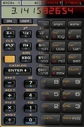
i41CX+
This is an advanced, programmable RPN scientific calculator with a virtual thermal printer and plotter.
Ohms Law Calculator
For Apple and Android (linked in the heading), use Ohm’s law to calculate voltage, current or resistance or a resistor in a circuit.
Electrical Formulator Pro
Calculate amps from AC and DC, kw, hp, watts, amps and so on. Charts on motors, wiring, voltage drop, power demand and safety codes.
French & German Vocab for Engineers
Learn French and German engineering terms with virtual flash cards.
Disaster preparedness
Online tools have taken a leading role in the immediate aftermath of some of the world’s recent big disasters. Here are a few mobile apps that may help.
Google Crisis Response
This isn’t a mobile app, but it’s a simple and effective onlne tool that puts Google’s people-finder, maps, news and information on where to donate all in one spot.
World Disaster Alert
The Pacific Disaster Center’s app is a list and interactive map of ongoing hazards around the world.
The American Red Cross: Shelter View
Find out where shelters have opened during a disaster.
Your suggestions for additional apps or other mobile services, new categories to include and reviews of what you’ve used are welcome.