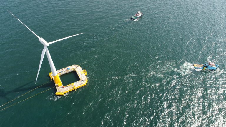
July 12, 2011

3D modeling and satellite imagery on a budget

Servir

This screen shot of a map in SERVIR shows a section of the East African coastline around Nigeria and Cameroon with visual data, such as roads, USGS land forms and soil fertility, overlaid.

Part Two in a two-part series. See Part One, on DIY aerial photography, here.

For the first time in the history of building things, powerful 3D modeling software is available for cheap or even free. Combined with satellite images freely available online, troves of land usage and climate data, and your own aerial photos—visualizing, mapping and monitoring your work site can be easy on a skimpy budget.

Rendering virtual 3D models is as simple as uploading geotagged aerial photos to a cloud-based program. As we showed in the last post, taking the aerial photos is the fun part. Then, assembling them into 3D models can save money and work down the road. And some people might think it’s fun, too.

How can 3D models help?

“I don’t see where it wouldn’t benefit. Urban housing projects, disaster projects, village projects, hydrological projects, …the list can go on,” says Wil Cao, a structural engineer at Parsons Brinckerhoff in New York City, and a member of the New York Professionals chapter of Engineers Without Borders-USA.

Cao and his EWB-USA team began building a dam and a levy in 2005 to control season floods on a river in rural Cambodia. They used a grab bag of techniques to visualize the project, piecing together topographic military maps with aerial photos from a DIY kite rig, from helicopter overpasses, and from firms selling satellite images.

3D model-making at a glance

Today, only a few years later, new software and online resources have made that kind of work even easier. GPS-enabled cameras can cost as little as $200. Put one in an aerial rig that you make yourself (here’s a guide), to take geo-tagged photos of the dam, school, bridge, hydroelectric generator or whatever structure you’re building. Then upload those shots into a cloud-based 3D modeling program like Pix4D.

No GPS-enabled camera? You can manually add longitude and latitude coordinates to any photo’s meta data with ExifTool.

Pix4D is a full-service modeler. As such it comes with a price tag. For especially anemic budgets, try the free version of Google’s SketchUp. SketchUp can model buildings and integrate your models right into Google Earth. If your project site gets enough attention from satellites, you’ll have free, relatively detailed aerial photos and maps around a model of your structure.

What satellites can do for you

Two wings of the US government have teamed to map about a dozen different kinds of data relevant to international development projects. The US National Aeronautics and Space Administration and the US Agency for International Development have pooled their collective information storehouses, including satellite images, predictive models, climate and other data, into a freely-available public service called SERVIR.

The information is slotted into eight focus topics: disasters, ecosystems, biodiversity, weather, water, climate, health, and agriculture. SERVIR has helped USAID map illegal slash and burn incursions into a tract of protected rainforest in Guatemala, for example, and others have used it to track changes in biodiversity and climate, and to respond to disasters such as wildfires and dangerous algal blooms.

“The web portal is being updated but is the source of much freely-available information from satellites, ground measurements, and model outputs, which SERVIR is providing for the regions it supports,” a SERVIR spokesperson at NASA headquarters told E4C in an email.

“Technologies nowadays may be more affordable, thus, why not?” Cao says. “With or without new online tools, the work can still be done. But with them, it’ll be done quicker (which offsets the cost).”

This was the second of a two-part overview on aerial mapping and 3D modeling. Please see Part One: Do-it-yourself aerial photography: a guided tour

Leave a Reply

Join a global community of changemakers.

Become A Member