Agriculture
August 29, 2024
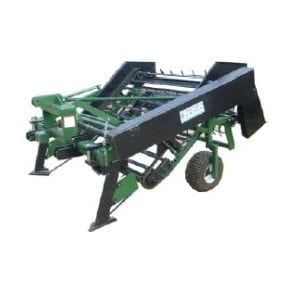
Alvan Blanch Groundnut Lifter/Inverter
Read SolutionImplemented by
Alvan Blanch
Updated on June 12, 2024
·Created on October 8, 2018
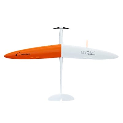
Delair DT18 is an agricultural drone to survey, monitor, and inspect fields.
The Delair DT18 AG is an agricultural drone to survey, monitor and inspect fields. It aims to report on crop status over long ranges.
Target SDGs
SDG 2: Zero Hunger
SDG 9: Industry, Innovation and Infrastructure
Target Users (Target Impact Group)
Household
Distributors / Implementing Organizations
Delair Tech and authorized distributors, Frontier Provisions
Competitive Landscape
Direct competitors include Honeycomb AgDrone, Wings for Aid, and Drones for Development Dr.One.
Regions
Worldwide
Manufacturing/Building Method
Manufactured in serial production in Toulouse, France
Intellectural Property Type
Copyright
User Provision Model
Direct sales and authorized distributors
Distributions to Date Status
Unknown
Drone type
Fixed-wing
Weight (kg)
2 kg
Take off / Landing type
Hand launched or catapulted/Belly (no damage to crops)
Carry case dimensions (m)
N/A
GNSS system
GPS
Flight time (hour)
2 hrs
Cruise speed (km per hour)
61 km/h
Battery type
Unknown
Sensors available (Y/N)
Yes, MicaSense RedEdge Multispectral Camera
Type of data collected
Raw data compatible with photogrammetry software
Drone software platform
Unknown
Application
Design Specifications
Technical Support
Manufacturer
Replacement Components
Available from manufacturer
Lifecycle
Unknown
Manufacturer Specified Performance Parameters
Long range UAV for inspection and survey, covers up to 1150 HA per flight, 2 kg weight, 5 Narrow spectral bands, VLOS BVLOS Certified
Vetted Performance Status
The results of the research done with Maisadour Semences:
Safety
Advanced safety features (real-time front video, autopilot fail-safe mechanisms, geofencing).
Complementary Technical Systems
Sensor:
Academic Research and References
Mancini, B. The Great Reconnaissance: A UAV Project in Niger. GeoInformatics; Emmeloord Vol. 17, Iss. 6, (Sep 2014): 6-8.
Mancini, B. and Aumont, J. Mapping Quickly and with Accuracy. GeoInformatics; Emmeloord Vol. 18, Iss. 6, (Sep 2015): 6-8.
Wayumba, R.. Mwangi, P., and Chege, P., Application of Unmanned Aerial Vehicles in Improving Land Registration in Kenya, International Journal of Research in Engineering and Science (IJRES), Volume 5 Issue 5 ? May. 2017 ? PP. 05-11
Larrieu, N., How can model driven development approaches improve the certification process for UAS?, 2014 International Conference on Unmanned Aircraft Systems (ICUAS), Orlando, FL, 2014, pp. 253-260.
“Delair Support – Delair.Ai Software and Professional Drones Support.” 2018. Delair – Professional Drones and Aerial Data Solutions. September 17, 2018. https://delair.aero/delair-drones-support/
Pradille, Alexis. 2018. “Delair and Frontier Precision Sign Agreement to Offer Expanded Commercial Drone Sales and Service in the US – Delair.” Delair – Professional Drones and Aerial Data Solutions. February 26, 2018. https://delair.aero/press/delair-and-frontier-precision-offer-expanded-commercial-drone-sales-service/
“Goal 2.” n.d. Sdgs.Un.Org. Accessed June 11, 2024. https://sdgs.un.org/goals/goal2
N.d. Delair.Aero. Accessed June 12, 2024. https://delair.aero/wp-content/uploads/2017/03/DT18-AG-datasheet-1.2_WEB-1.pdf
Delair-Tech. 2016. 1top8 – 3D Model by Delair-Tech (@gael.Brelet). https://sketchfab.com/3d-models/1top8-33c5c4aa9a43484f82269f0c910a8b9f
N.d. Delair.Aero. Accessed June 12, 2024. https://delair.aero/wp-content/uploads/2017/07/Use-case-_-AF_-Phenotyping-V-2.1.pdf
N.d. Delair.Aero. Accessed June 12, 2024. https://delair.aero/wp-content/uploads/2016/10/WEB_Use-case-_-AF_Precision-Agriculture.pdf
Compliance with regulations
Certified for daily BVLOS operations (since 2012)
Evaluation methods
Other Information
Agriculture
August 29, 2024
Implemented by
Alvan Blanch
Agriculture
June 22, 2024
Implemented by
Bespoke Design Concepts
Agriculture
September 12, 2024
Implemented by
KSNM
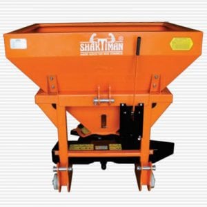
Agriculture
January 10, 2024
Implemented by
Shaktiman
Agriculture
June 12, 2024
Implemented by
Parrot
Agriculture
February 6, 2024
Implemented by
SAYeTECH Ltd

Agriculture
June 11, 2024
Implemented by
Trringo
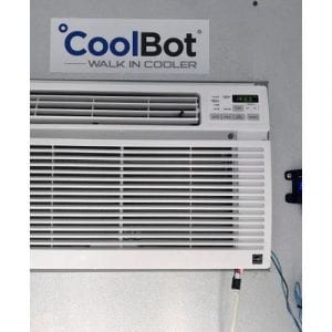
Agriculture
December 26, 2023
Implemented by
CoolBot
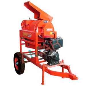
Agriculture
September 19, 2024
Implemented by
Amaragri
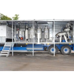
Agriculture
September 18, 2024
Implemented by
Alvan Blanch
Have thoughts on how we can improve?
Give Us Feedback